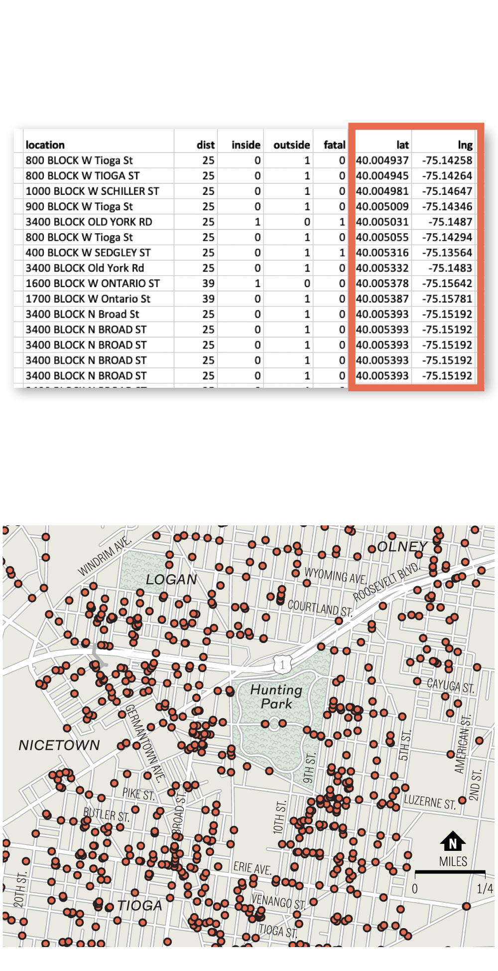
Mapping Shootings in Philadelphia
Since 2015, the Philadelphia Police Department has published a detailed database of every shooting in the city, totalling nearly 13,000 incidents. The data includes geographic coordinates, shown here as latitude (lat) and longitude (lng) in decimal degrees …
… and these coordinates can be brought into a mapping program to produce dots on a map marking their locations. The map below shows where the coordinates shown above appear on a map among the nearly 1,000 shootings since 2015 that occurred around Philadelphia’s Hunting Park neighborhood.
Source: Philadelphia Police Dept.
John Duchneskie / Staff Artist

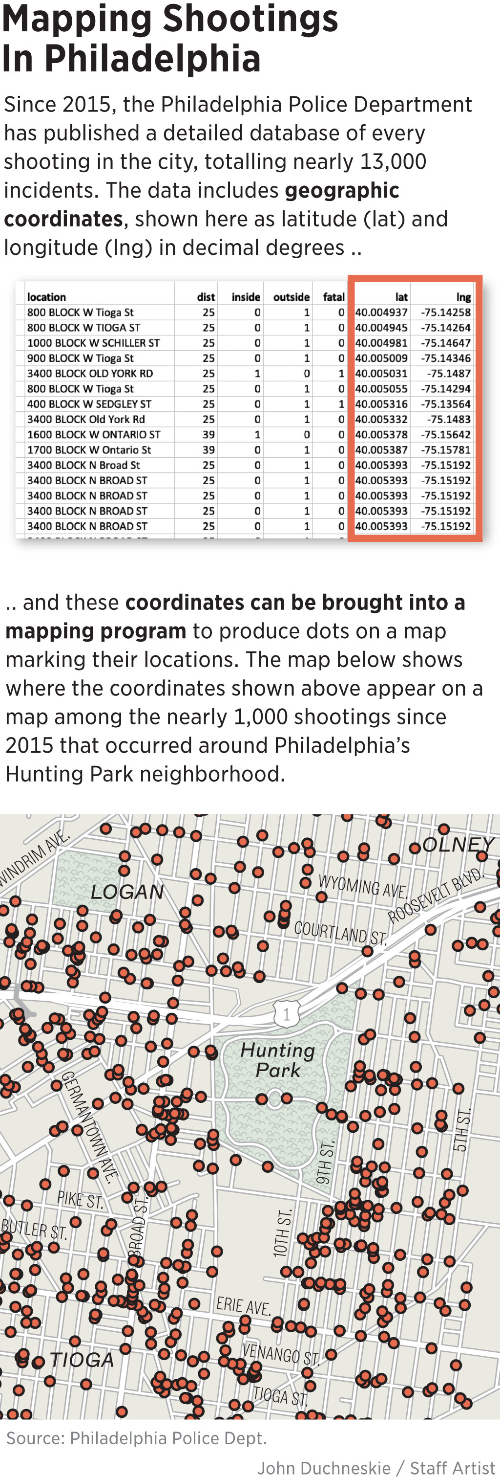
Mapping Shootings
In Philadelphia
Since 2015, the Philadelphia Police Department has published a detailed database of every shooting in the city, totalling nearly 13,000 incidents. The data includes geographic coordinates, shown here as latitude (lat) and longitude (lng) in decimal degrees …
… and these coordinates can be brought into a mapping program to produce dots on a map marking their locations. The map below shows where the coordinates shown above appear on a map among the nearly 1,000 shootings since 2015 that occurred around Philadelphia’s Hunting Park neighborhood.
Source: Philadelphia Police Dept.
John Duchneskie / Staff Artist