Violent Blocks and the Legacy of Redlining in Philadelphia
In the 1930s, the federal government oversaw the creation of racist appraisal maps that deemed sections of cities as “hazardous” or “declining” based primarily on the presence of communities of color. Residents of these “redlined” neighborhoods had limited access to mortgages, which led to disinvestment and poverty in Black and Latino neighborhoods.
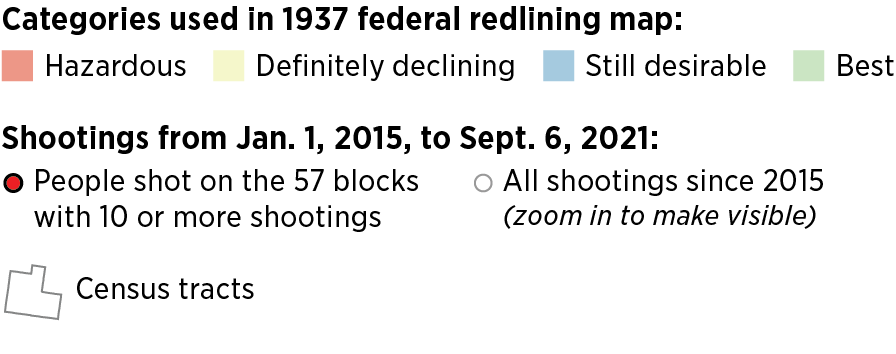
Decades later, many of these same neighborhoods in Philadelphia are home to blocks with devastating levels of gun violence. There are 57 blocks where 10 or more people have been shot since 2015, and 53 of those blocks are in areas deemed undesirable over 80 years ago.
The map below shows these blocks, as well as the 1937 federal government redlining zones and census tracts with demographic information. Click and zoom in on the map for more information.